FURTHER HEAVY rain is forecast across the Tweed Shire during the next two days as the Bureau of Meteorology (BOM) issued a severe weather warning for the Northern Rivers this morning (Monday, June 12).
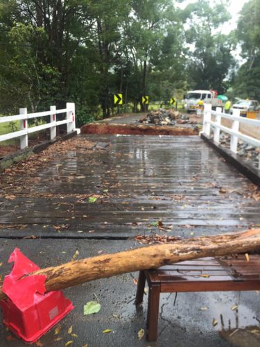
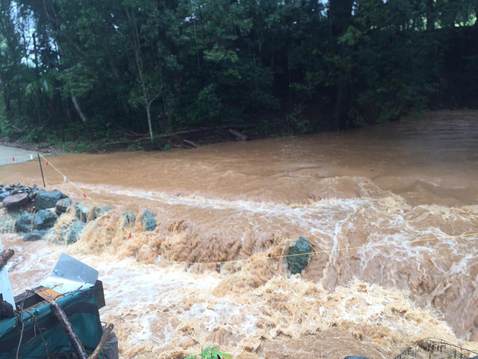
BOM is yet to release a flood warning for the Tweed Shire, with only a “flood watch” so far in place, however areas such as Mooball and Upper Burringbar are experiencing flash flooding with flood-prone roads inundated since Sunday (June 11).
A BOM forecaster told The Weekly that a slow-moving low-pressure trough along the NSW north coast is causing the persistent rain which is likely to become “heavy at times” during the next two days.
However, the forecaster said the weather patterns were not comparable to ex-tropical cyclone Debbie, which dumped more than 100mm in less than two hours and more than 700mm in less than three days.
“Rainfall totals in excess of 150mm have fallen in the past 48 hours to 9am today (June 12), with some locations such as Tweed Heads reaching 53mm since 9am today (alone),” the forecaster at BOM said.
“During the ex-tropical cyclone Debbie the Tweed Shire experienced more than 100mm in two hours, which is not the case here and we’re seeing more like 100mm in 24-hour periods.”
The BOM warning also said that up to 200mm further may fall in parts of the Tweed Shire and surrounds during the next two days.
“Some catchments may receive higher,” the statement reads.
The forecaster warned that further heavy rain and possible flash flooding were predicted for the Northern Rivers.
(Second opinion) The situation according to Higgins Storm Chasers
“An upper level cold cored cut off low is forecast to move East into south east Qld and north east NSW during Monday (June 12) and Tuesday (June 13) generating instability. A surface low pressure system is forecast to begin developing off the SE QLD coast on Monday while intensifying and moving closer to the coast on Tuesday. The system is expected to weaken during Wednesday.”(https://higginsstormchasing.com/hsc-severe-weather-alert-for-seqld-nensw/)
Meanwhile, Murwillumbah SES remain on standby although volunteer rescue teams have only so far assisted with leaky roofs.
The SES wanted to advise people to:
* Not drive, ride or walk through flood water.
* Keep clear of creeks and storm drains.
* Seek refuge in the highest available place if you are trapped by water and ring 000 if you need rescuing.
* For emergency help in floods and storms, ring your local SES Unit on 132 500.
Warnings are also available through TV and Radio broadcasts, the Bureau’s website at www.bom.gov.au or call 1300 659 218. The Bureau and State Emergency Service would appreciate warnings being broadcast regularly.
As you can see from the river levels (below and featured picture) most remain steady or are falling, however this could change as further rainfall takes place.
Latest river heights (Tweed Shire)
| Station Name | Time/Day | Height | Tendency | Flood Class | Recent Data |
|---|---|---|---|---|---|
| Tweed River | |||||
| Tyalgum Bridge | 10.06am Mon | 1.77 | steady | Plot | Table | |
| Clarrie Hall Dam | 10.09am Mon | 61.75^ | falling | Plot | Table | |
| Clarrie Hall Dam D/S | 9.58am Mon | 1.26 | steady | Plot | Table | |
| Tweed R at Palmers Road | 10.08am Mon | 1.60 | steady | Plot | Table | |
| Tweed R at Uki | 10.11am Mon | 2.75 | steady | Plot | Table | |
| Oxley R at Eungella | 5.10am Mon | 1.59 | Plot | Table | ||
| Tweed R at Bray Park Weir | 10.08am Mon | 2.67 | steady | Plot | Table | |
| Tweed R at Murwillumbah | 10.09am Mon | 0.67^ | steady | below minor | Plot | Table |
| Rous R at Chillingham | 9.56am Mon | 1.61 | steady | Plot | Table | |
| Tweed R at Tumbulgum | 10.09am Mon | 0.46^ | steady | Plot | Table | |
| Tweed R at Barneys Point (mAHD)** | 10.11am Mon | 0.41^ | steady | below minor | Plot | Table |
| Tweed R at Dry Dock | 10.14am Mon | 0.33^ | steady | Plot | Table | |
| Cudgen Creek | |||||
| Cudgen Ck at Kingscliff | 9.30am Mon | 0.31 | steady | Plot | Table | |
| Cudgen Lake at Bogangar | 9.00am Mon | 0.93 | steady | Plot | Table | |
Where to report road damages:
Motorists who see fresh damage on Tweed our roads are asked to report it to Tweed Shire Council so it can be logged for repair by telephoning our Contact Centre on (02) 6670 2400 during office hours or 1300 292 872 after hours or by downloading Tweed Shire Council’s app from the App Store or Google Play.
BOM update expected at 5pm (June 12)


